
How Riverline Is Reclaiming Tulsa’s Riverfront
Two Rainier leaders on the $400 million public-private plan reshaping 37 acres along the Arkansas River.
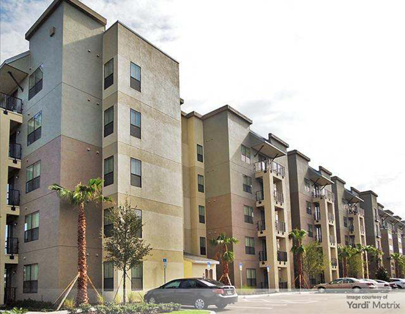
Along a 37-acre stretch of the Arkansas River corridor in Tulsa, Okla., a long-underutilized site is poised for transformation. Riverline, a $400 million redevelopment planned on the grounds of a former trailer park, aims to introduce a mix of multifamily housing, experiential retail and publicly accessible spaces designed to reposition the riverfront as an active commercial and community destination.
Rainier Development Co. is leading the project in partnership with the Muscogee (Creek) Nation, under a framework established by the city of Tulsa and the Tulsa Authority for Economic Opportunity. At full build-out, Riverline is expected to include approximately 650 luxury apartments and about 200,000 square feet of retail, dining and entertainment uses, with the first phase slated to begin construction later this year.
In this conversation, Danny Lovell, president & CEO of The Rainier Cos., and David Neher, president of Rainier Development Co., discuss the project’s capital structure, development phasing and the long-term strategy reshaping this stretch of Tulsa’s riverfront.
When evaluating the Riverline site, what stood out about this location in terms of long-term demand and market fundamentals?
Lovell: The site is situated within the highly regarded Jenks School District and benefits from strong demographics that support a solid, dependable customer base for both multifamily development and retail uses, with top-performing schools and high household incomes fueling ongoing demand for housing and experiential retail.

In what ways does Riverline fit within the city’s long-term vision for the river corridor?
Lovell: The development aligns with Tulsa’s Arkansas River Corridor Master Plan and PlaniTulsa goals to focus on mixed-use, walkable development nodes along the river, while also utilizing underused land with excellent visibility and access at the intersection of South Tulsa and Jenks, Okla., an area well-suited for high-quality reinvestment.
Riverline builds on the area’s substantial public investments in parks, trails and river-corridor infrastructure, enabling the project to enhance existing activity and connectivity. It also directly supports the city’s long-term goal of creating a vibrant, connected riverfront district by adding new housing, commercial uses and opportunities for public participation in a location identified for catalytic growth.
READ ALSO: Top Emerging Housing Markets
Plans call for some 650 units set above 200,000 square feet of retail, dining and entertainment spaces. How do these uses support one another in creating a walkable district?
Neher: Riverline is centered on the ‘district effect,’ a mixed-use concept that combines a best-in-class retail node with other uses to create a lively, walkable urban-scale destination for residents and visitors alike.

The approximately 650 apartments generate natural demand for a curated mix of retail and restaurants. In contrast, the around 200,000 square feet of experiential retail energizes the streetscape, increases dwell time and acts as a major amenity for residents. Ground-floor retail beneath residential units maintains continuous day-to-evening activity, supported by wide sidewalks and pedestrian-friendly public spaces.
The residential program caters to a wide range of residents, from young professionals to empty nesters. It features units from studios to three-bedroom homes in both garden-style and podium formats, supported by surface, covered and structured parking.
Through shared infrastructure, parking and amenities, the project enhances efficiency and promotes cross-use synergy. As the first significant retail-driven mixed-use development of its kind in this corridor, Riverline acts as a catalyst for improved quality, design and density in South Tulsa.
Riverline is moving forward under the Southern Villa Project Plan devised by the city. What does this plan entail and what public-realm elements did you prioritize for the first phase?
Neher: Rainier Development and the Muscogee Nation collaborated closely with PartnerTulsa to develop a public-private partnership that supports Tulsa’s long-term economic development goals. This partnership creates a unique and cooperative relationship between tribal and local governments to pursue a shared vision for South Tulsa.
The Southern Villa Project Plan established three incremental districts to fund essential public infrastructure, including streets, utilities and public space improvements, while also prioritizing new housing, job creation, long-term tax base growth and reinvestment in aging and underutilized areas.
In Phase One, the most noticeable public-realm improvements will include pedestrian-focused sidewalks and crossings, new and upgraded infrastructure, improved landscaping and lighting, and streetscapes designed to encourage retail activity. The phase also introduces trail connections and open-space integration that promote accessibility, along with a new signalized intersection on Riverside Parkway that will provide safe, direct access from this heavily trafficked corridor, enhancing visibility and traffic flow.
What does this initial phase of the project include exactly and how will it establish the framework for the later stages of development?
Neher: Phase One of Riverline will deliver approximately 282 multifamily units and around 120,000 square feet of curated retail and dining, anchored at the north end of the site, along with the essential public infrastructure needed to support the district. …
This initial phase will set the architectural, placemaking and public-realm standards for the entire district, defining the main street corridor, site circulation and overall quality of future phases. Delivering the multifamily and experiential retail components together ensures broader initial activation and fosters a sense of place from day one. Infrastructure and site planning have been designed for efficient southward expansion, and strong performance in Phase One is expected to attract future tenants, investment and complementary uses that will support the long-term viability of the complete mixed-use vision.
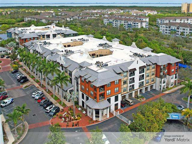
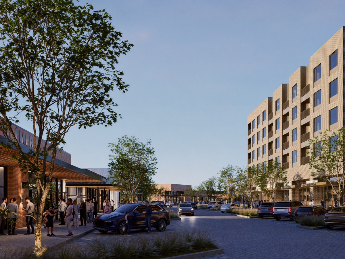
To rise within the Jenks School District, Riverline will include a mix of multifamily, retail and public spaces. All images courtesy of The Rainier Cos. 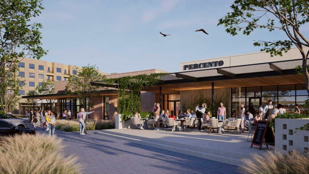
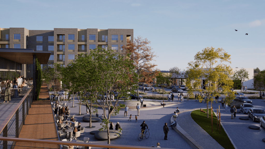
At full build-out, Riverline will comprise 200,000 square feet of retail, dining and entertainment spaces. 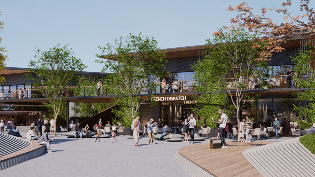
The retail spaces will be complemented by plazas, pocket parks and outdoor gathering spots.
The project has placemaking and connectivity as key goals. How are these concepts expressed in the design of public spaces, streetscapes and links to the existing river-trail network?
Neher: Riverline’s placemaking strategy centers on a cohesive main street corridor that guides the entire district and balances efficient vehicular access with an enjoyable pedestrian experience through wide sidewalks, active frontages and carefully scaled intersections. Public spaces are deliberately placed along this corridor, including plazas, pocket parks and outdoor gathering spots that foster natural opportunities for connection and community interaction. Phase One features enhanced streetscapes with shade, seating, lighting and native landscaping, all designed to encourage longer stays and a more enjoyable pedestrian environment.
The plan also includes direct links to the regional river-trail network and a future trailhead, connecting Riverline to Tulsa’s broader recreational system and enhancing overall site connectivity. Internal circulation emphasizes clear, intuitive pedestrian pathways from residences and parking areas to storefronts, reducing conflicts with vehicles and supporting a walkable district design. Together, the main street corridor, high-quality public spaces and trail integration establish Riverline as a connected, experience-focused district where recreation, retail and community life naturally enhance one another.
READ ALSO: Building Communities, Not Just Buildings
Developing on the riverfront often involves complex coordination among jurisdictions and infrastructure providers. What have been the main challenges so far in aligning those pieces and how are they being addressed ahead of groundbreaking?
Neher: Riverfront development requires careful coordination among transportation, utility and permitting agencies. From the beginning, the team has been intentional about aligning these efforts to keep the project on a clear, predictable course.
Because of site drainage conditions and related factors, the team chose to start the Section 404 permitting process early, which has involved detailed environmental reviews, collaboration with the U.S. Army Corps of Engineers and coordination across multiple jurisdictions to address potential impacts on regulated waterways. …
Close coordination with the City of Tulsa’s engineering and traffic teams has been especially essential for the new signalized intersection on Riverside Parkway, as well as the roadway and utility extensions needed to support the development. PartnerTulsa has played a crucial role in streamlining communication between the Muscogee Nation and the city, ensuring permitting, infrastructure planning and timing stay aligned across jurisdictions.
By advancing permitting, drainage design, roadway improvements and utility coordination early in the process, the project is well positioned to move toward groundbreaking in 2026.
The site’s proximity to the Arkansas River and Joe Creek also raises questions of sustainability and resilience. What strategies have you incorporated to ensure long-term environmental performance and flood readiness?
Neher: Riverline is being carefully developed around nearby mitigation easements overseen by the U.S. Army Corps of Engineers, with full respect for and enhancement of all environmental requirements. A large mitigation area north of the site will be protected with fencing to prevent human disturbance, while also encouraging the natural flow of stormwater toward the Arkansas River and reducing the entry of pollutants and debris. On-site stormwater management will include bioswales to naturally filter runoff before it is collected and discharged, further protecting water quality.
The landscape design features a large tree canopy across the site, providing important environmental benefits such as cleaner air, lower urban heat, better stormwater management through rainfall interception and increased habitat for wildlife. To prevent flooding, a double-celled box culvert will be built through the center of the site, allowing part of the property to be removed from the floodplain and developed safely. All buildings will be positioned outside the FEMA floodplain and raised above historic flood levels, ensuring long-term resilience and environmental responsibility.
READ ALSO: Resilient Design: 4 Apartment Case Studies
Mr. Lovell, you’ve grown up in nearby Henryetta, Okla. What does this project mean to you? Do you have a favorite feature?
Lovell: Having grown up in Henryetta, this project is very personal to me because it reflects the kind of catalytic investment that I wish more Oklahoma communities could experience. Riverline offers an opportunity to help develop a top-tier district in Tulsa that still feels authentically like Oklahoma and to prove that our state can deliver projects that compete with any market.
My favorite feature is the riverfront access. We have seen many developments invest heavily to ensure that mixed-use districts feel genuinely connected to a river or water feature, not just nearby, through trails, open spaces and pedestrian connections that make a district genuinely walkable and livable. If we get that right, Riverline becomes a place people use every day, not just on weekends or for special events, and that is what ultimately creates lasting value for both the city and our partners.
Looking ahead, what do you hope Riverline will contribute to Tulsa once complete, both as a mixed-use destination and as a model for future public-private partnerships?
Lovell: Riverline has the chance to become a true gateway for South Tulsa—a place that attracts talent, employers and visitors while also giving residents another reason to stay, invest and build their lives here. It will expand the tax base, create jobs and help connect surrounding neighborhoods through a more vibrant and connected river corridor.
As a public-private partnership, Riverline shows how public and private capital can work together around a shared vision to achieve more than either could alone. This model has proven successful in other parts of the country and provides Tulsa and other Oklahoma communities with a clear blueprint for future projects that are financially disciplined, community-driven and built to last.