
3 Ways to Re-Think Urban Planning Post-COVID
Casey Case of Gates & Associates on how cities can improve walkability and open-air amenities.

Casey Case
The past two years under the COVID pandemic have changed life in many ways, including how cities will be managing their growth and design. Some trends that were already in place are simply being accelerated, while others are newer and more significant than the average citizen might expect. In our work advising many growing, pro-active cities in the Western U.S., we are finding several key themes dominating our conversations with local leaders, our meetings with neighbors and the community, and our resulting design-plans of re-imagining what a town could be.
In most U.S. communities, the streetscape system comprises the largest portion of public land. Today there is a growing movement to re-think the use of this public resource to create livable streetscapes: an environment that is pedestrian friendly rather than auto-dominated.
U.S. adults polled in the National Association of Realtors biennial survey reported that living in a walkable community correlates to a significantly stronger quality of life—and that metric rose during the pandemic.
With more people working from home and increased emphasis on community walkability, there are numerous emerging opportunities for optimizing street real estate, to support changing consumer demand and to use these precious shared right-of-ways.
Here are some of the main trends and forward-thinking ideas gaining traction:
1. Fewer Parking Places, More People Spaces
Making cities more walkable at the expense of cars is a long-standing trend gaining new momentum after the pandemic’s push to “get outside.” Major U.S. cities, including San Francisco, Oakland and San Jose, are evolving city planning to institutionalize some of the beneficial responses that came out of the lock-down and mask-up era.
Palo Alto, Calif., for example, is re-thinking the streetscape design for University Avenue to have more sidewalk space and walkability, in balance with fewer cars and parking. Their approach is based on experience. The city’s California Avenue was upgraded some years ago to be more pedestrian-focused and became a case study success with more sidewalk space and less parking. In the pandemic, the city went even further and closed California and University to cars as street cafes and parklets wooed customers to outdoor spaces. University was later re-opened but California remains closeable for pedestrian-only special events. And the city is studying whether to close it permanently, and is also establishing a program for permanent parklets, reflecting sentiment from some of its retailers as well as a 5,000-signature petition of support.
2. Pedestrian-Centric Urban Centers
Some towns are in a better position to facilitate change by taking it in increments, such as a block or several blocks of a street, or a central grid that can accommodate pedestrianization—with parking available nearby.
In Fairfield, Calif., along the I-80 corridor east of San Francisco, the city is considering major pedestrian-centric changes in a small part of downtown that offers a test case for new ideas, with a longer-range plan for expansion and adjustment. As seen in Gates’ proposals to the city, artist images show narrower streets, changed paving and visual cues that slow down traffic, with a transformative array of pedestrian-friendly improvements such as wider sidewalks, outdoor furniture, additional landscaping, and bike areas.
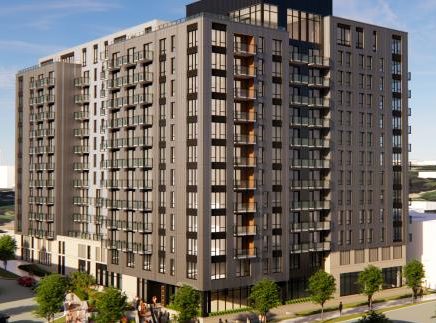
By contrast, the City of Fremont had a near blank-slate opportunity to plan the development around its new Warm Springs BART train stop envisioned to accommodate 20,000 jobs and 4,000 residential units. Echoing a long-range vision the city requested from the Urban Land Institute in 2012, the new Warm Springs District is now home to a vital mix of housing, office and mixed-use buildings, parks, a school, pedestrian-bike paths and related amenities. The former industrial area, now a Transit-Oriented Development, is a poster-child of planning a pedestrian-centric community. A network of parks, paths and greenways knits the community together, giving pedestrians and bicyclists easy maneuvering. At the same time, streets are designed for safe use for cars, bikes, and pedestrians.

Palo Alto CA, offers a model for cities re-thinking their urban planning amid the increased demand for walkability over parking and cars post-COVID. Photo courtesy of Gates + Assoc.
One innovation taking root in city planning is woonerfs, a Dutch term roughly encompassing “slow streets”. A Gates + Associates woonerf at the nexus of the train station plaza eases the transitions with hike/bike routes and adjacent multifamily apartment housing at the Innovia and Aya apartments.
3. Parks and Urban Greenspace
With the pandemic, people went outdoors in droves seeking respite and fresh air, rediscovering places they didn’t know were nearby and even overwhelming some parks. It’s led to many cities reevaluating, and in some cases expanding, their green spaces to promote outdoor activities, hiking and native habitat renewal.
Belmont, in the Silicon Valley peninsula, is in the midst of a master-plan process to re-think its parks and open spaces. Among the qualities that will drive the new plan is evaluating parks for equal access for all ages, abilities, and socio-economic groups, and enhance citizens’ access to open space. And they’re actively exploring ways to make livable streetscapes a seamless part of the new park system.
The coronavirus pandemic led many people to maximize access to fresh air, green space and sunshine, and it’s driving more and more decisions in urban planning and community design. For planners, landscape architects and park designers—whose mantra is akin to “let’s get more people outside”—it’s a welcome advancement.
Casey Case is president of Gates & Associates, a landscape architecture and urban design firm in Walnut Creek, Calif.